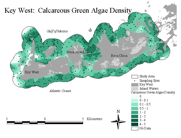
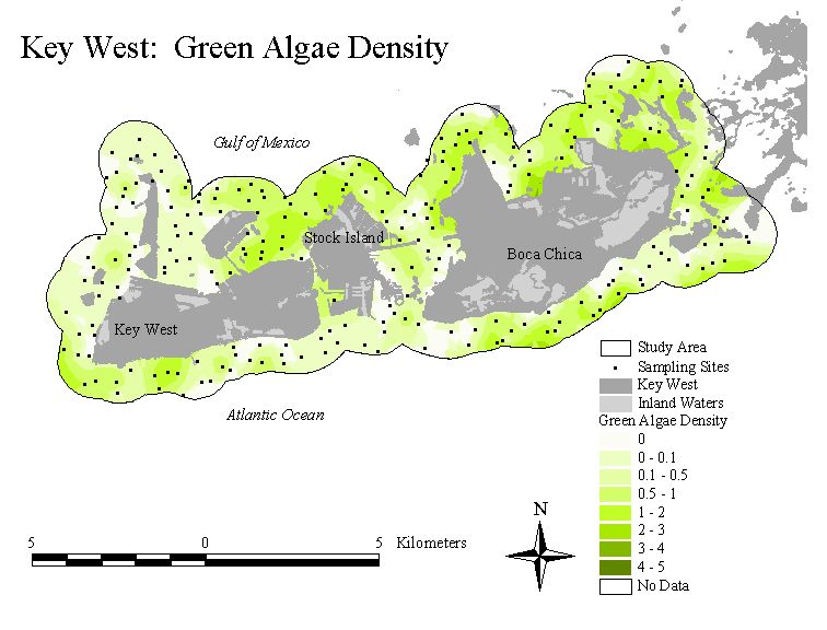
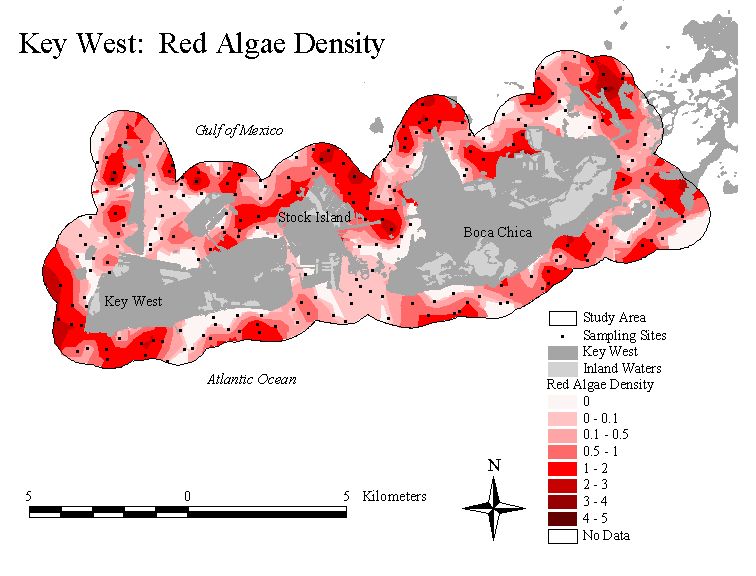
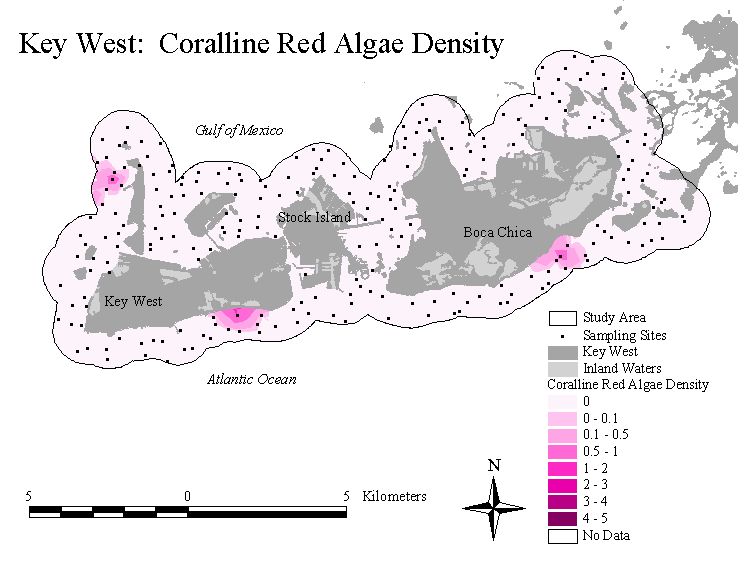
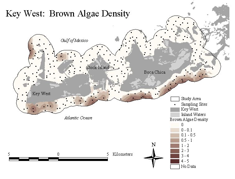
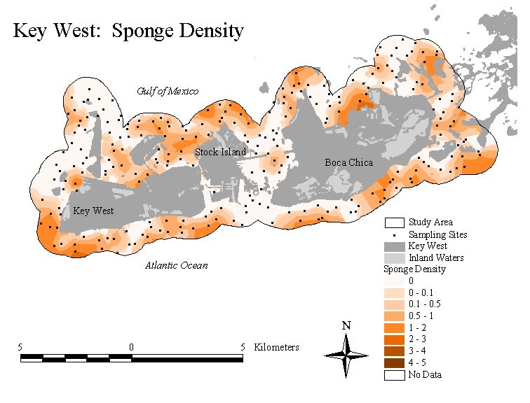
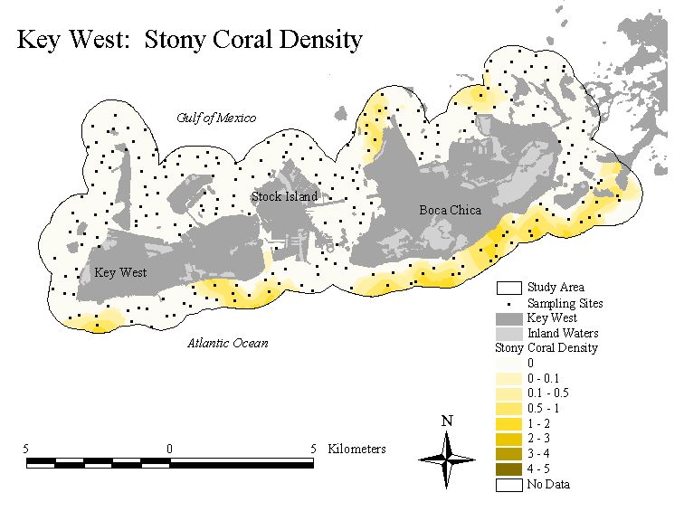
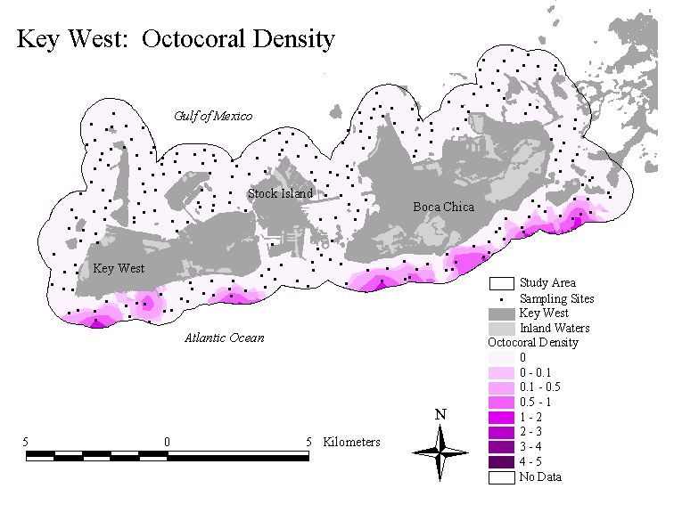
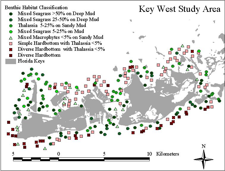
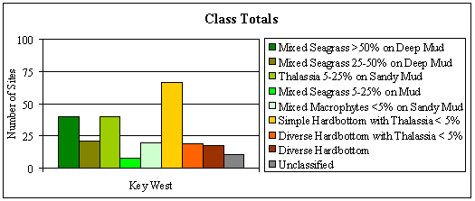
Nearshore
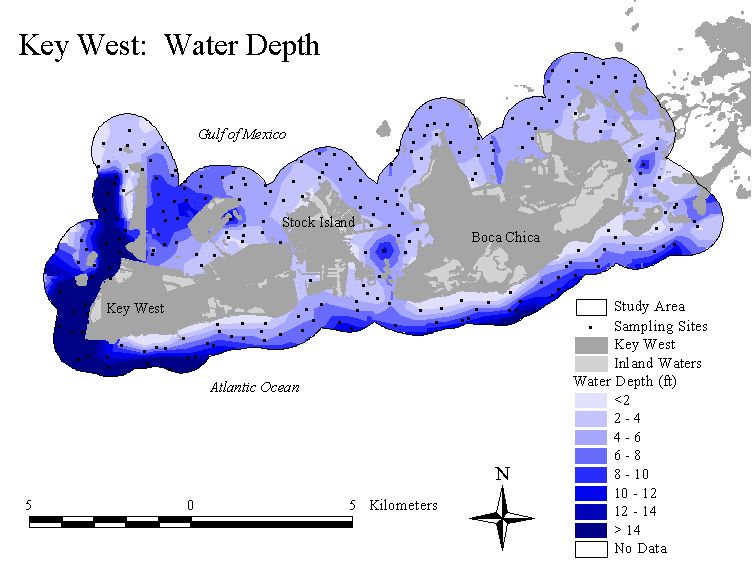
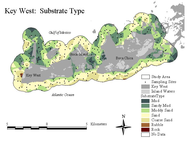
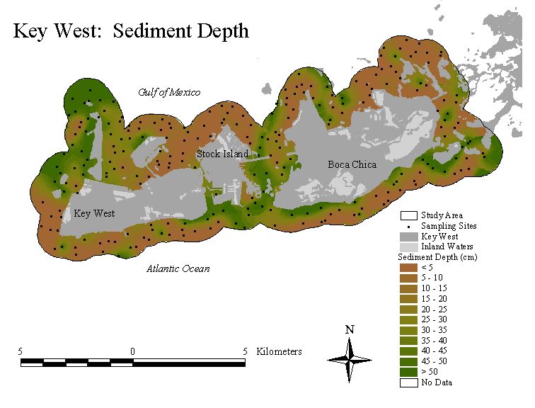
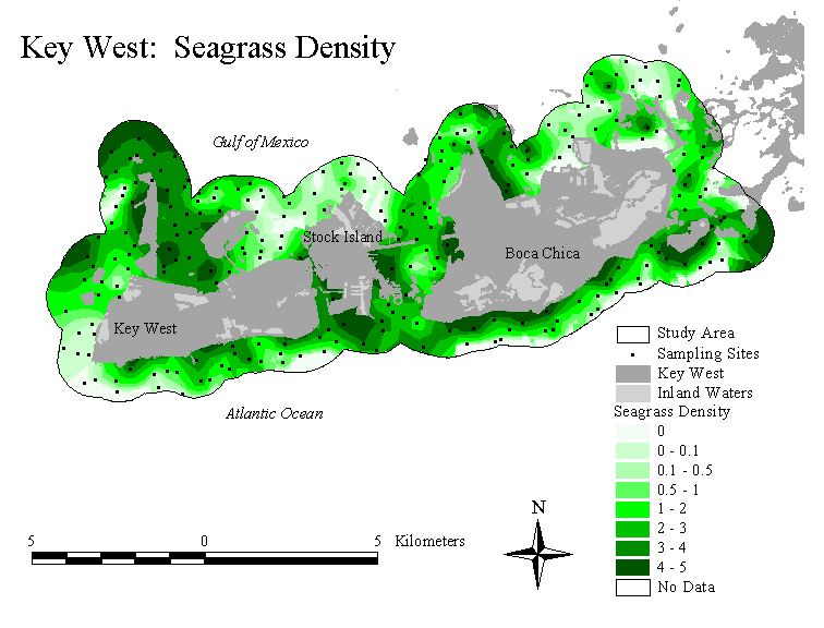
benthic community composition was documented at approximately 1400 sampling
locations throughout the Florida Keys study area
(click on thumbnails for enlarged maps)
Physical data, such as water depth, substrate type, and sediment depth were also recorded at each site. Interpolated surfaces for physical data were also created using a universal kriging algorithm.
(click on thumbnails for enlarged maps)
| # | Class | Detailed Class Description | |
| 2 |
|
Mud >40cm deep with >50% mixed seagrass cover (predominantly Thalassia, with some Syringodium and Halodule). Abundant calcareous green algae. Sparse green algae. | |
| 5 |
|
Mud >40cm deep with 25-50% mixed seagrass cover (predominantly Thalassia with some Halodule). Abundant calcareous green algae. Sparse green algae and sponges. | |
| 1 |
|
Sandy mud 30-40 cm deep with 5-25% Thalassia cover. Dense calcareous green algae. Abundant red algae. Sparse green algae and sponges. | |
| 3 |
|
Mud 30-40 cm deep with 5-25% mixed seagrass cover (predominantly Thalassia, with some Syringodium and Halodule). Abundant calcareous green algae. | |
| 4 |
|
Sandy mud 20-30 cm deep with <5% mixed seagrass cover (predominantly Thalassia, with some Halodule). Abundant calcareous green algae. Sparse green algae, red algae, and sponges. | |
| 6 |
|
Hardbottom with <5% Thalassia cover. Dense calcareous green algae and red algae. Abundant green algae and sponges. Sparse stony corals. | |
| 7 |
|
Hardbottom with <5% Thalassia cover. Dense calcareous green algae, green algae, and red algae. Abundant sponges. Sparse brown algae, stony corals and octocorals. | |
| 8 |
|
Hardbottom. Dense calcareous green algae and red algae. Abundant green algae, brown algae, and sponges. Sparse coralline red algae, stony corals and octocorals. | |
|
Note: the categories "Sparse", "Abundant", "Dense" are all <5% cover) |
Temporal Variation in Nearshore Benthic Communities: Key West Study Area
Nutrient Regimes of Nearshore Benthic Communities: Key West Study Area
Relationships Between Project Data and Florida Keys Land Use: Key West Study Area
Home Report Study Area Data Locator