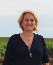
Rosanna Rivero, Ph.D.
Affiliated Faculty, SERC

Dr. Rivero’s area of interest is in the field of regional planning and landscape ecology, with particular emphasis in GIS (geographic information systems) and remote sensing. Dr. Rivero initial work was conducted in the Llanos of Venezuela, as part of Orinoco-Apure program with the Ministry of Environment. During the last 8 years she has been involved with various research projects in Florida, through the University of Florida, the Center of Spatial Analysis at the Florida Fish and Wildlife Conservation Commission, and recently with the science group at the Everglades Foundation, in Miami. Dr. Rivero’s work in the Everglades was focused on the integration of GIS, remote sensing and geostatistics in order to improve soil phosphorus predictions in WCA-2A. Her current area of research is in Lake Okeechobee, reconstructing morphological changes associated with variations in water levels, lake shoreline, bathymetry and topography, using historic navigational charts and hydrographic surveys from 1925 as well as other sources, and relating these to vegetation and hydroperiod conditions.

